Services Plugins FAQs

Mapbox Markers Help

Hi Ive managed to display a cluster of markers, but I am struggling with some of the next stage functions that I am after (which may or may not currently be possible)

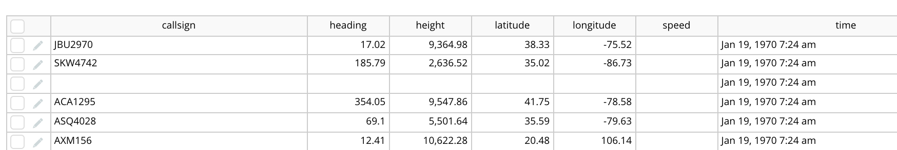
Firstly, here are the database fields I am working with:

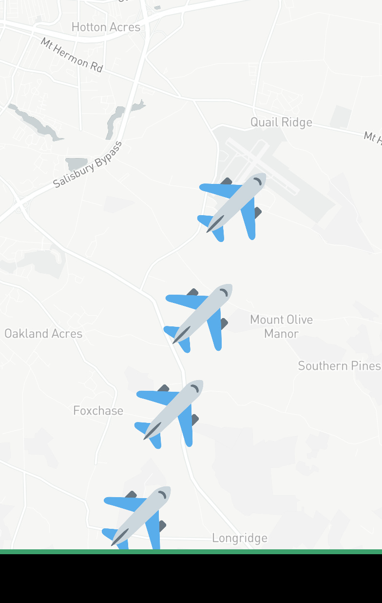
  1. Rather than a bunch of markers (like shown below), can I display a single marker on the last location report of a plane and the rest of the locations just a single line where the plane has been in the past (as if it were plotting a route)

  1. My database includes the heading of the planes. I would like to be able to change the direction of the marker to match the heading. If these markers were just a normal image element, I could manually rotate them but how can I orientate the mapbox markers based on the heading field?

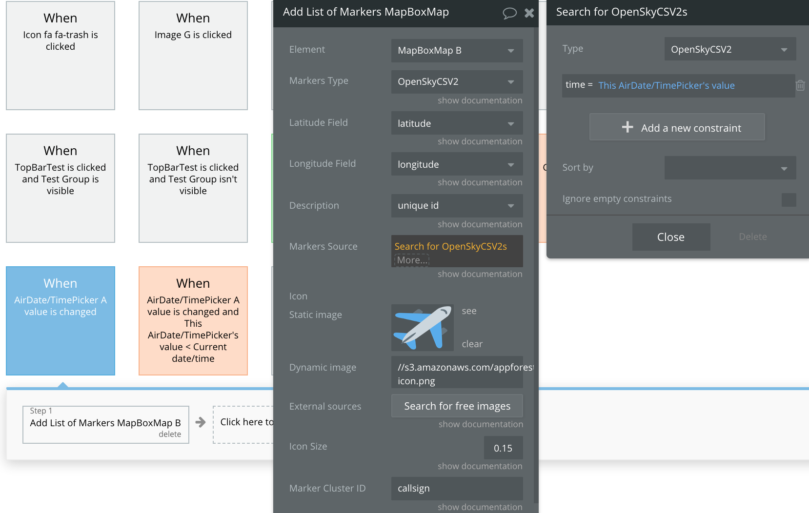
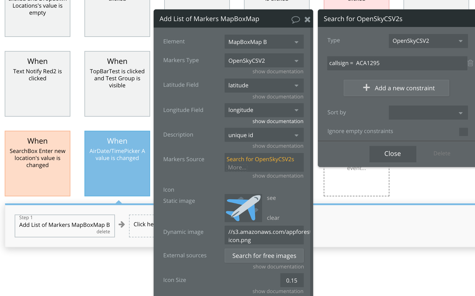
  2. I would like to display all available markers at a specific point in time. To select the time I am using Air Date Picker. However, my implementation must be wrong because I see no markers when I set the time in the date picker to the time shown in my database.

Hi @alex3,

Thank you for reaching out. Here are the answers to your questions:

  1. Yes, you can implement this logic and display only one marker to the latest location. I would suggest you check the documentation we have, where you can find Actions to better understand the possibilities of the plugin, here at https://docs.zeroqode.com/plugins/mapbox-maps-plugin
  2. I’m afraid the plugin currently doesn’t support the functionality of pointing to a direction, but technically it is possible to implement such logic in your workflow
  3. It is possible to display the markers at a specific point in time. Try to make sure that this one plugin is configured properly, but in case you experience similar issue, you can contact the issuer the plugin has been developed by. Unfortunately, I couldn’t help you this time as the plugin has not been developed by Zeroqode

Hope it is helpful!

Best regards,
Alexandru

hi @alexandru, thank you for your prompt response.

  1. Displaying one marker i am fine with but how can I display one marker icon and draw a line to all the other markers in the cluster?

  2. Could you steer me in the right direction to achieve this, please? The marker drawing is handled by the mapbox plugin as far as I can see and I can’t see a way of targeting them in order to rotate them.

  3. No problem I can contact them but do let me know if you see anything glaringly incorrect in the image I shared above.

Thank you

For some reason I cant get markers to show at all now. Im just trying to show this one plane which has a callsign of ACA1295 (see above photo to see that this call sign is in the database). The markers should be shown if there is any change to the date picker

Hi @alex3,

Based on provided screenshots everything seems to be ok. The drawing functionality can be done with setting a route from origin to a destination and it would display it on a map, using “Set direction” action.

Regarding the rotation logic I’m afraid I could not tell exactly, but you can check the Bubble forum here https://forum.bubble.io/ and try find a solution form the community. Also, you could check the online courses we have on Bubble here at https://lab.zeroqode.com/

However, thank you for providing us with this feedback as our team will improve the plugin and perhaps add some new functionality to it to make things simple. In case you have other suggestions, we would highly appreciate if you share with us.

Best regards,
Alexandru

Hi @alexandru, unfortunately, I can’t get any clusters to show at all at the moment. A single marker based on GPS location works though.

Ive disabled the data picker and recreated the list event to happen on page load as shown below. Ive also tried a different callsign but still nothing.

Re. your advice about setting a route, would i need to try and do this between each waypoint ? I wouldnt just want a single line going directly from the first and last marker

Hi @alex3,

I am afraid the are indeed some issues with the plugin itself at the moment. We are investigating the possible problem to try fix it and notify you back as soon as possible. Our apologies for the inconveniences.

Regarding route marks, If I’m getting it right and you are trying to build a travel app and you want to display the route of an airplane with multiple stops, I would suggest you find some online solutions, as I’m sure there are already different ways of doing it. We cannot guarantee and provide exact solutions regarding development, I hope you understand. But I’ll try to steer you in a direction. You could use live tracking and/or setting an origin-destination route from one point to another of a flight. As soon as the plane reaches its first stop, you could update the coordinates for new origin and new destination of this flight, so the stop becomes new origin and the new destination becomes final stop of the flight, and displaying the route on the map.

Hope it is helpful.

Best regards,
Alexandru

Hi @alexandru, ok thank you for letting me know there are some issues currently.

Not quite. I have a database that has the lat and long of a plane that was captured every 15 minutes or so during its flight. I would like to draw a single line from the first detection to the last detection and then show a plane icon on the last detection. It will look like a trail is coming from the back of the plane icon about where it used to be in the sky.

Hi @alex3,

We are reaching out to notify you that plugin issues with markers have been fixed. It should be working fine by now. In case you experience similar problems, please let us know.
Please do upgrade the plugin to latest version. Refresh the application and give it a try.
Thanks for understanding!

Best regards,
Alexandru

1 Like