Services Plugins FAQs

🗺 Bubble's Google Map Extender - New Plugin from Zeroqode

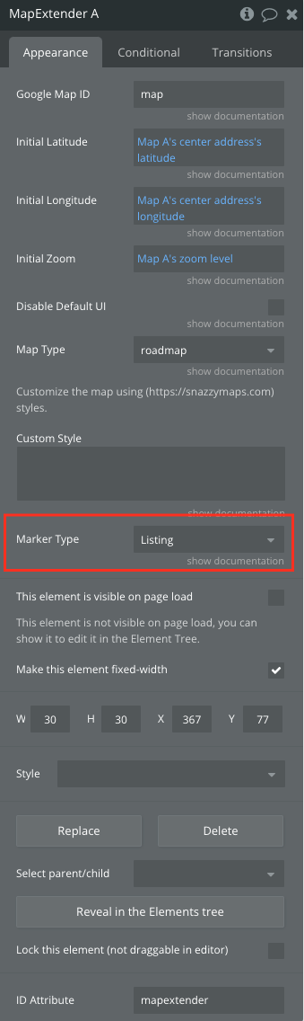
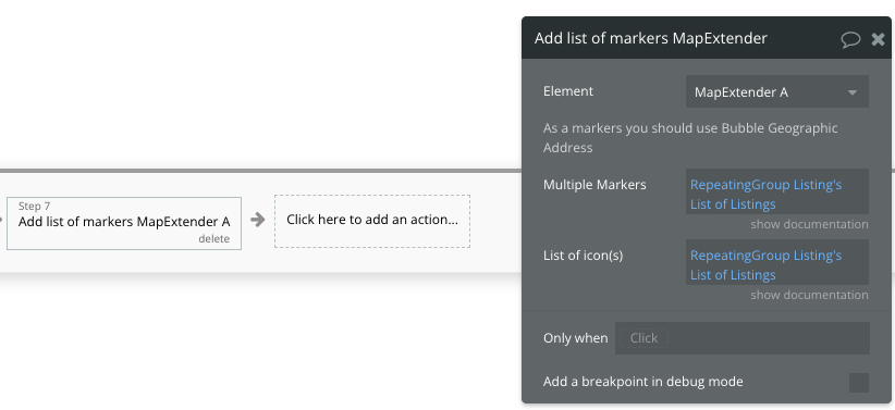
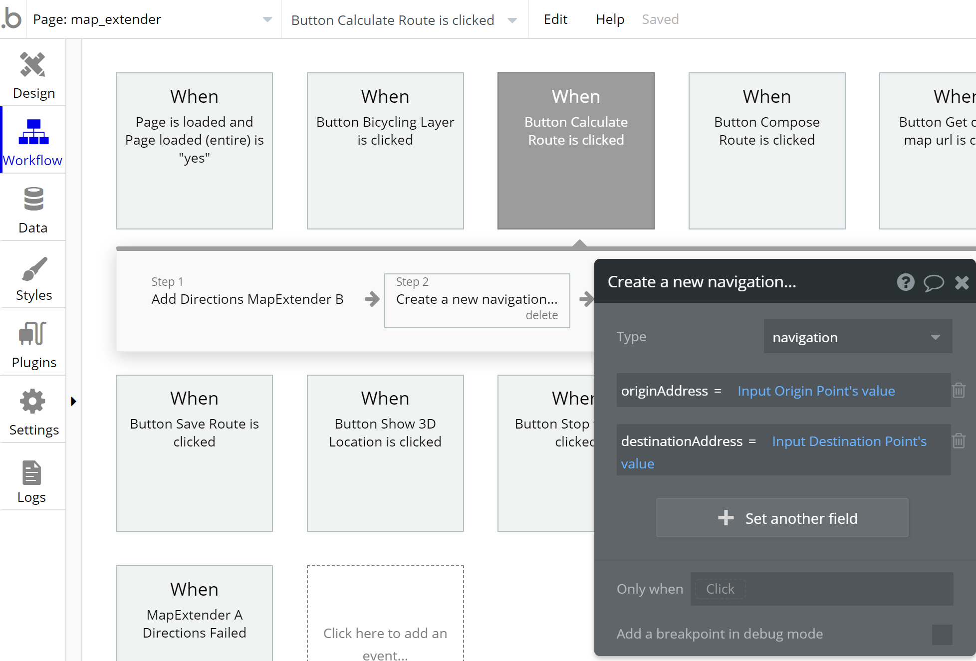
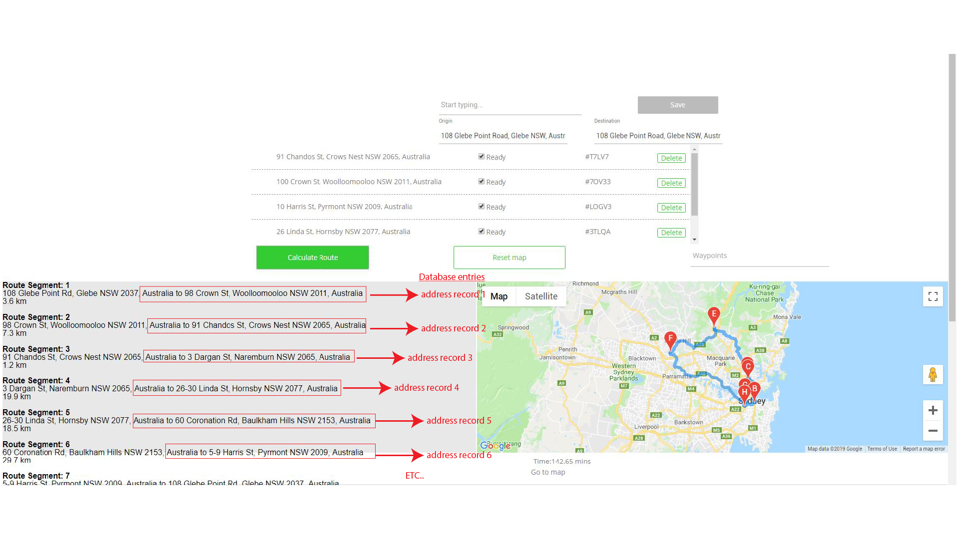
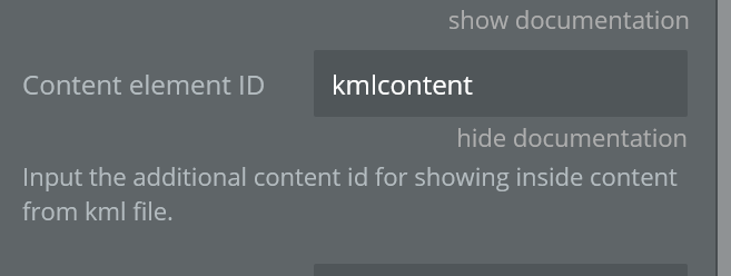
Hi @Dumitru, I’ve purchased this plugin and gotten it to calculate routes and output to a map and Group element the way you have set it up in the demo, however how would you go about reading the addresses back into your database in the order of the calculated route?

Ultimately I want to output those addresses to navigation to enable the user to navigate from waypoint to waypoint. Thanks for any help.

Hello @mihira

Try simply creating a new thing with the addresses of your route into database.

After that you could output the results to users for navigation.
Please try this out.

Best,
Dumitru.

Hi @Dumitru, I’m not sure i’ve explained clearly. Please see the screenshot below:

We are basically using the route calculator to give a new sort order to the address records in the database. Would this be possible? Thanks for looking into it.

Hi @olga.medvedeva, I was talking to you on another string about the same plugin and thought I should copy you in. Would appreciate any help on this. Thanks!

Just looking for a way to read the Route Segment data that is output into the group element.

Hi @mihira.

Olga will not be able to reply, unfortunately. I am taking over her, thanks.

Regarding saving your route into database seems like an issue with the plugin but it should be definitely possible to, because after clearing things out what you wanna do I checked again the demo. So we’ll work on the issue and be back to you asap.
Thanks for understanding.

Best,
Dumitru.

Hi @Dumitru, Thanks so much for updating me.

1 Like

Hello @mihira

Okay we checked the scenario, however these addresses are not possible to save. The Save Route demo example it is used for Live Tracking.
You could save the Origin, Destination and Waypoints via inputs for example and from 2 states Direction’s Distance and Direction’s Duration you’ll get the time and distance.
Hope this helps.

Regards,
Dumitru.

Ok, thanks for looking into it @Dumitru. I will try a half-way solution for the time being.

The plugin is still useful for the price and has a great premise but when the calculated route cannot be used for other functions in the database it falls just short of some very powerful use cases. thanks for your help, however. I hope you can continue to develop this.

2 Likes

Thanks @mihira for support and kind words. We’ll definitely work on improving all products across the board in due time.
Thanks for understanding.
If you like our plugin, could you please rate it by going to Plugins tab in Bubble editor? You can find the plugin by name and give it as many stars as it deserves :slight_smile: The more feedback we get, the more motivated to build great plugins
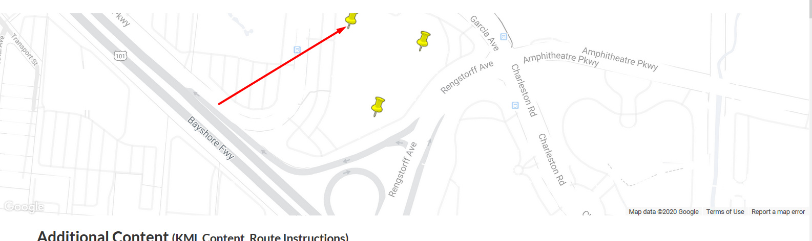
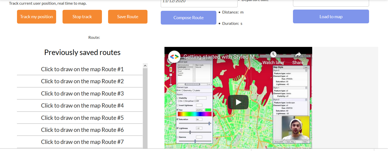
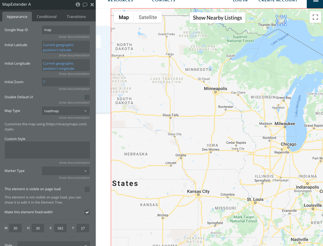
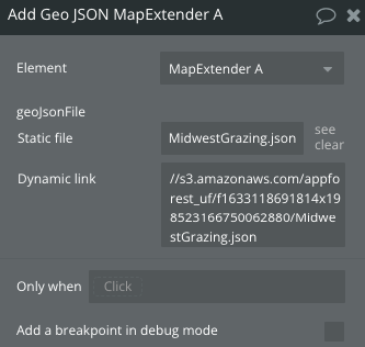
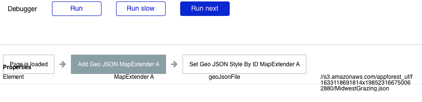
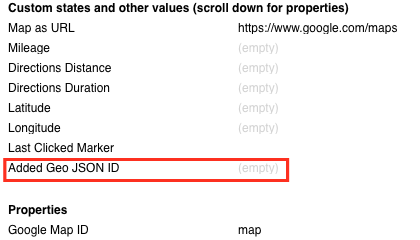
 :slightly_smiling_face:

Kind regards,
Dumitru.

I can’t get the 3d tilt to work. I can’t tilt it to see the horizon as I can in google maps. There are other issues as well with random heading changes and image distortion. I made a video showing some of the more basic errors.

EDIT: I think I understand it now - these aren’t the 3d reconstructions from google maps but rather actual satellite images, and thus are not available at multiple tilt angles.

Is there a way to lock the zoom on the scroll wheel as we can in the original map element?

Does anyone know how to get the KML Content field to work? I can view the kml but doesnt give any additonal info about the kml item…
image

Hi, @siteovation!

Thanks for reaching out!

Let me check this out and I’ll get back to you asap.

Best, Julia.

Hi, there!

So, I have investigated the plugin and it turns out that the field works, but the KML file should be correct in order to display its content.

Here are the steps of how to test the plugin.

  1. Download the Sample file here.

  2. Go to Live Demo page and upload the KML file

  1. Once the file is uploaded click on the layer on the map

and you will see the additional info about the kml item under the map near the Previously saved groups

Hope this helps!
Best, Julia.

Hey everyone! :grinning:

We are happy to announce that we finished redesigning our Demo page. Now it looks like our new web design. Also, we tried to make it easy and clear to use. Please check it out: https://zeroqode-demo-12.bubbleapps.io/map_extender.

Hope you’ll like it :slightly_smiling_face:

If you have any questions or suggestions please feel free to reach out to us!

Best, Julia

Hey Zeroqoders! :wink:

Usual Google Maps in Bubble can’t add layers, switch to 3d mode, show directions, track route, display KML… and many other things.
However THIS plugin brings Maps in your app to a new level :raised_hands:

:star_struck: See the demo: Bubble’s Google Map Extender Plugin for Bubble

Best regards,

Veronica Kornilova
Marketing Manager @ Zeroqode
#1 Bubble Publisher and Developer

logo-icon-S-circle

100+ Bubble Templates
25+ Bubble Courses
250+ Bubble Plugins
20+ Bubble Building Blocks
Convert Web to iOS & Android
No-code Development Services
Zero Code Conference Replay - watch all the no-code industry leaders share their expertise and insights on building and scaling startups without code

I’ve just purchased the plugin so I can use GeoJSON to overlay a “mask” on top of our existing map element.

I’ve followed the documentation, added the MapExtender element to the page with the map using the map’s ID attribute (“map” in this case):

I then created a workflow so on page load, the GeoJSON file is added to the MapExtender element:

image

And I confirmed in the Bubble debugger that the workflow is running as expected:

However, after the workflow runs, my next action to set the style by the ID of the added GeoJSON ID shows no ID available, and the GeoJSON ID shows as blank on the MapExtender element:

image

Where have I messed up?

I think I solved my own problem … I had the MapExtender element hidden. After making it visible, it does seem to be loading the GeoJSON correctly now :+1:

Hi @cbennett, thanks for your messages :slightly_smiling_face:
Glad to hear that plugin is working properly on your side.

In case any other plugin related question will appear, you know where to find us :wink:

Have a nice day!
Regards,

I’m trying to add a list of markers to my Extender and it doesn’t seem to be working.

In my database I have a type called “Listing” that contains a field called “Location” that is a geographic address.

Here are the element properties:

Here is the workflow and settings (I’m using a Repeating Group to generate a list of Listings that match certain criteria):

I think the problem is that in my Listing type, I have multiple image fields including the map pin icon and Map Extender might only work with a single image field, is that correct?